Skip to content
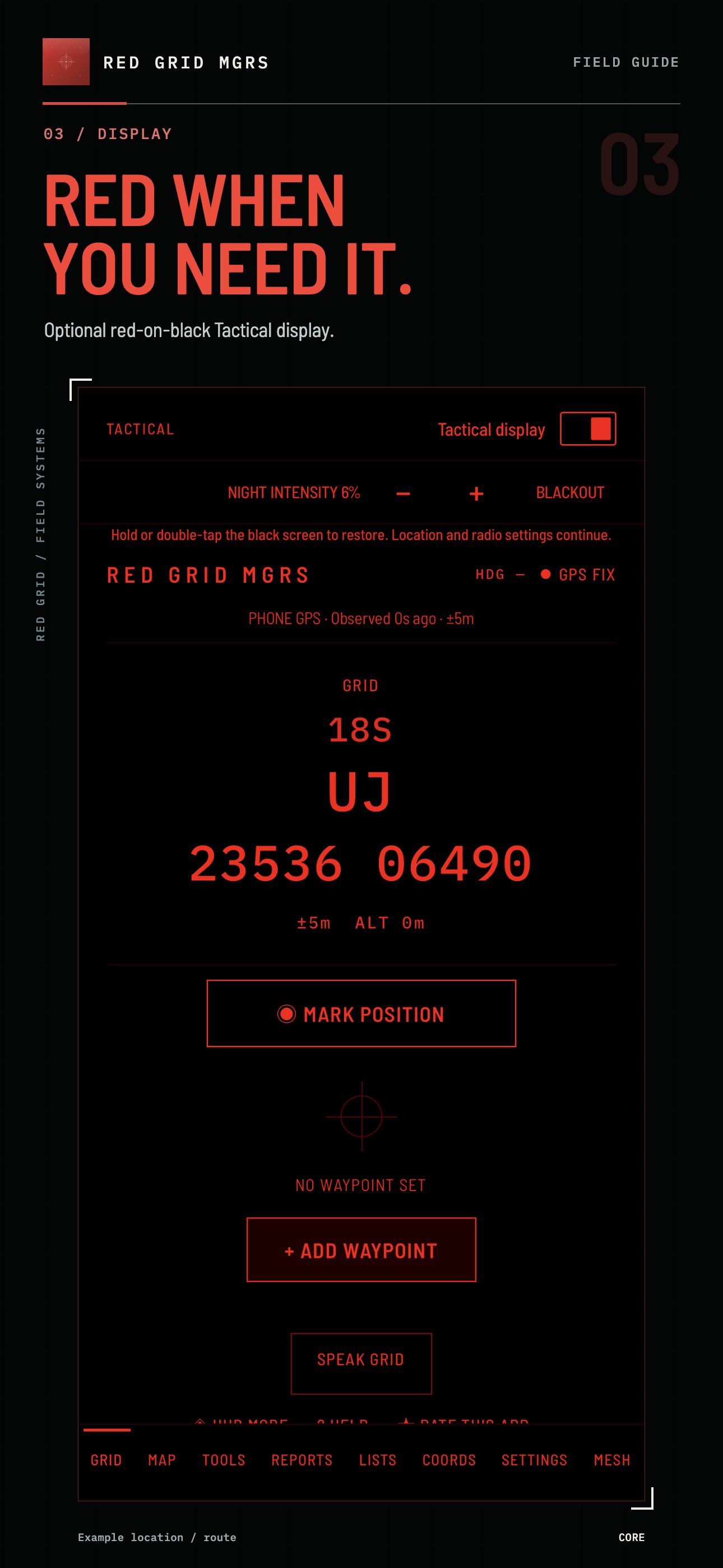
CURRENT RELEASE The display and field workflow shown are available in the current iOS and Android release from the stores.
Red Grid Tactical original logoRED GRIDTACTICAL

RED GRID MGRS / THE APP

YOUR FIELD KIT.
WITH A GRID
AT ITS CORE.

Read your position. Set your destination. Keep your bearings, calculations and reports in one practical navigator.

Free to download · Monthly and lifetime Pro options

Compare Free & Pro ↓
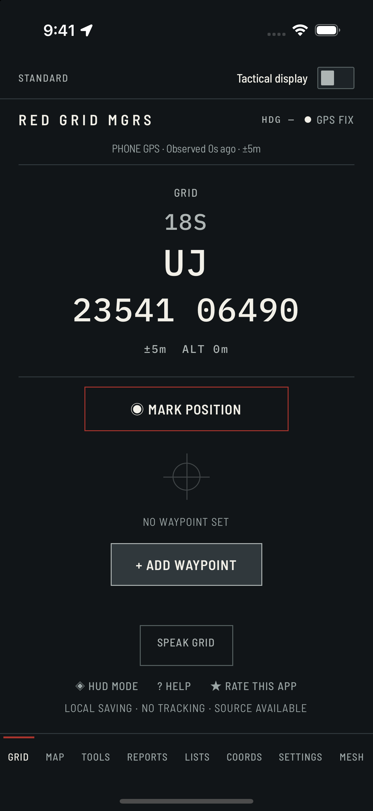
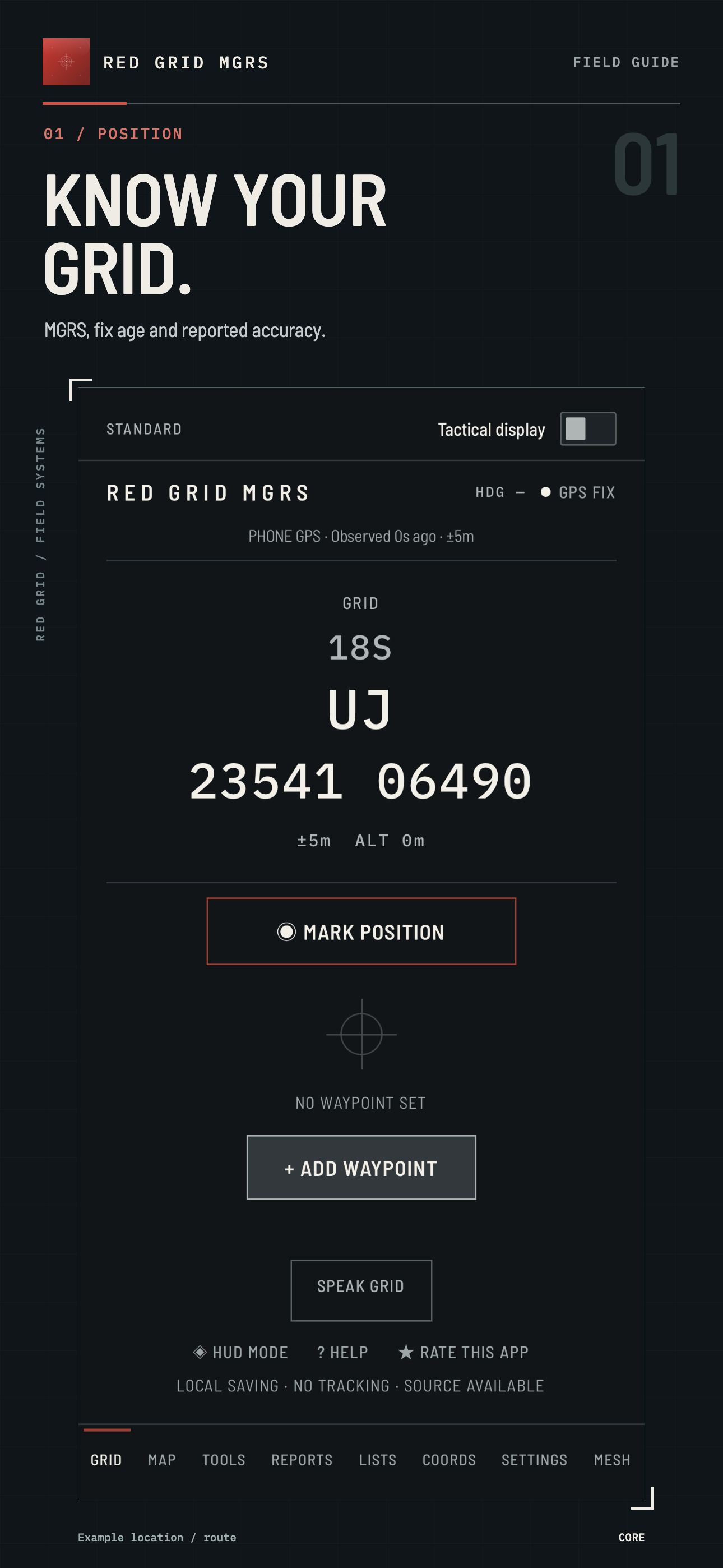
RED GRID MGRSSTANDARD
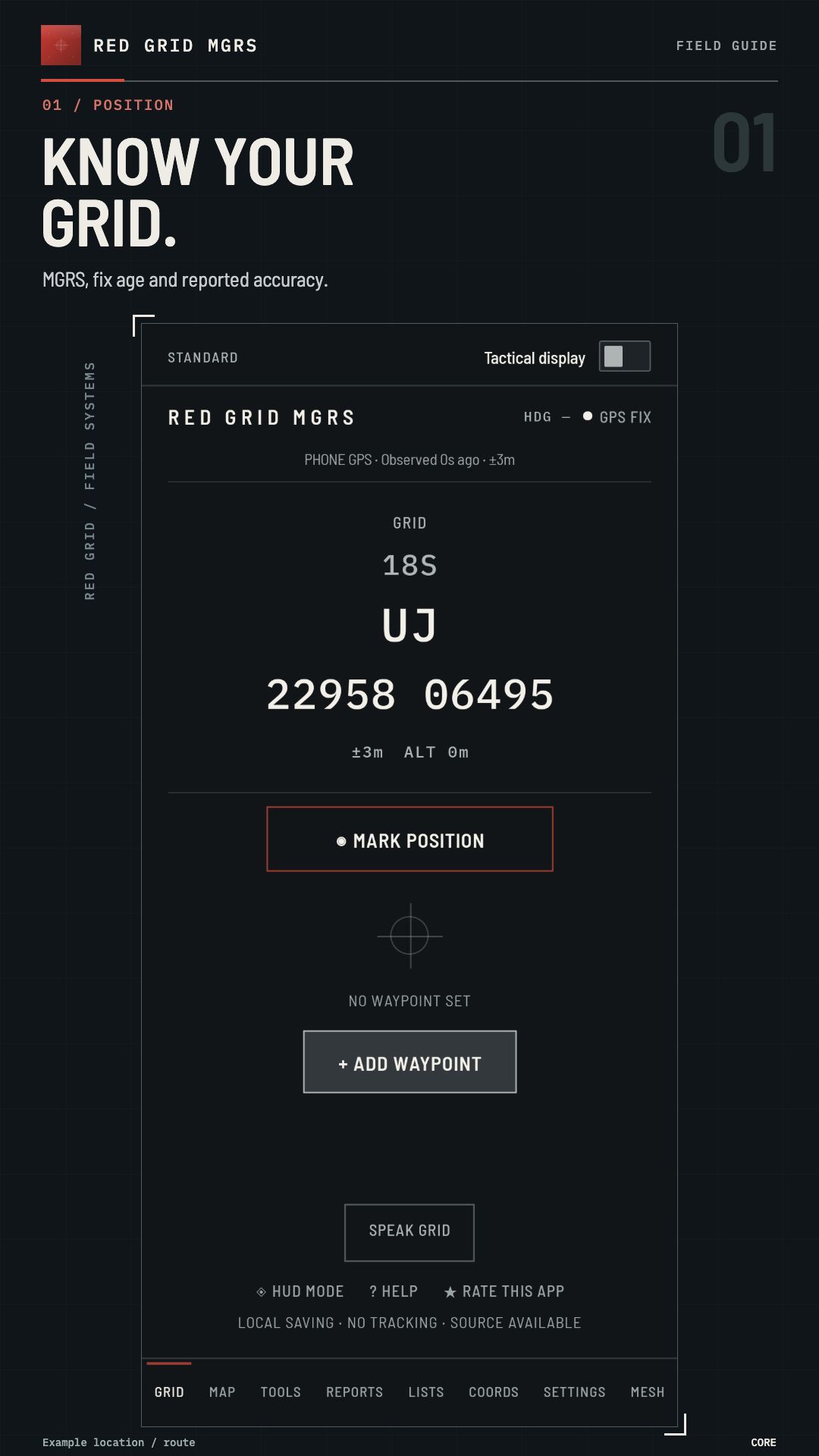
Red Grid MGRS · KNOW YOUR GRID.
Captured on iOS 4.1.0 (88) · current release available in the stores · Pro enabled · example location
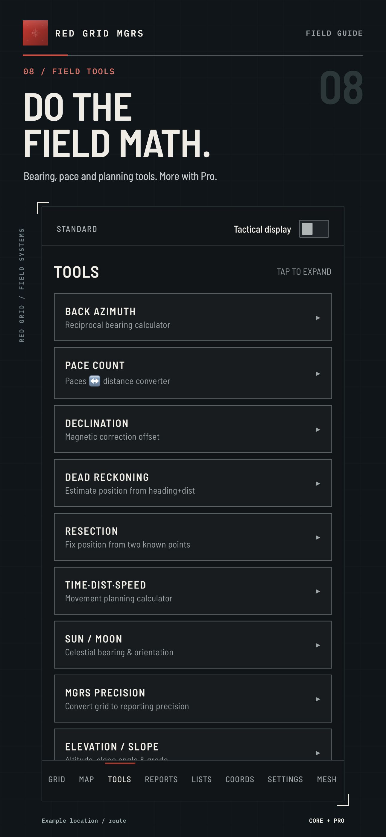
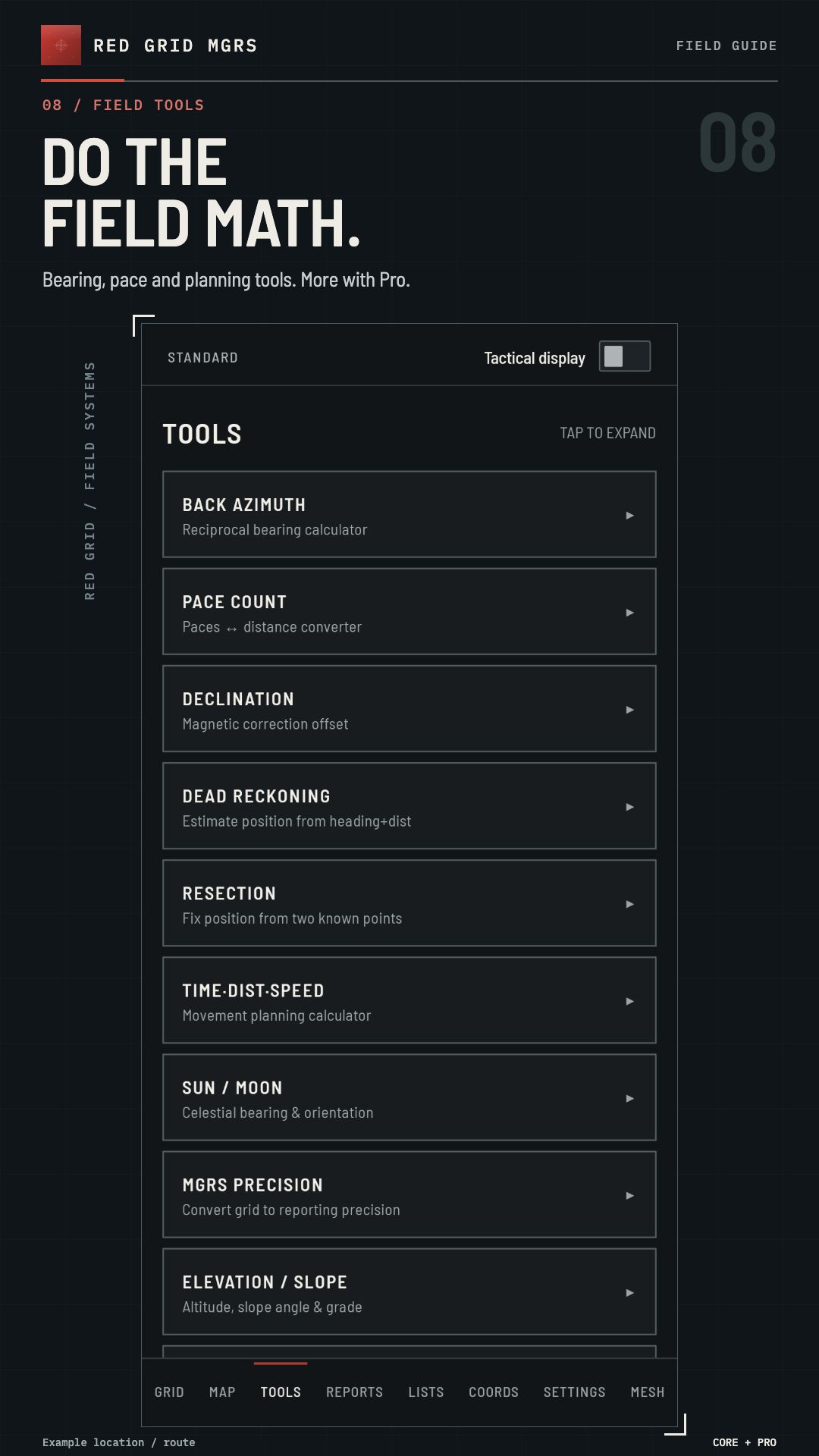
12 FIELD TOOLS4 free · all 12 with Pro
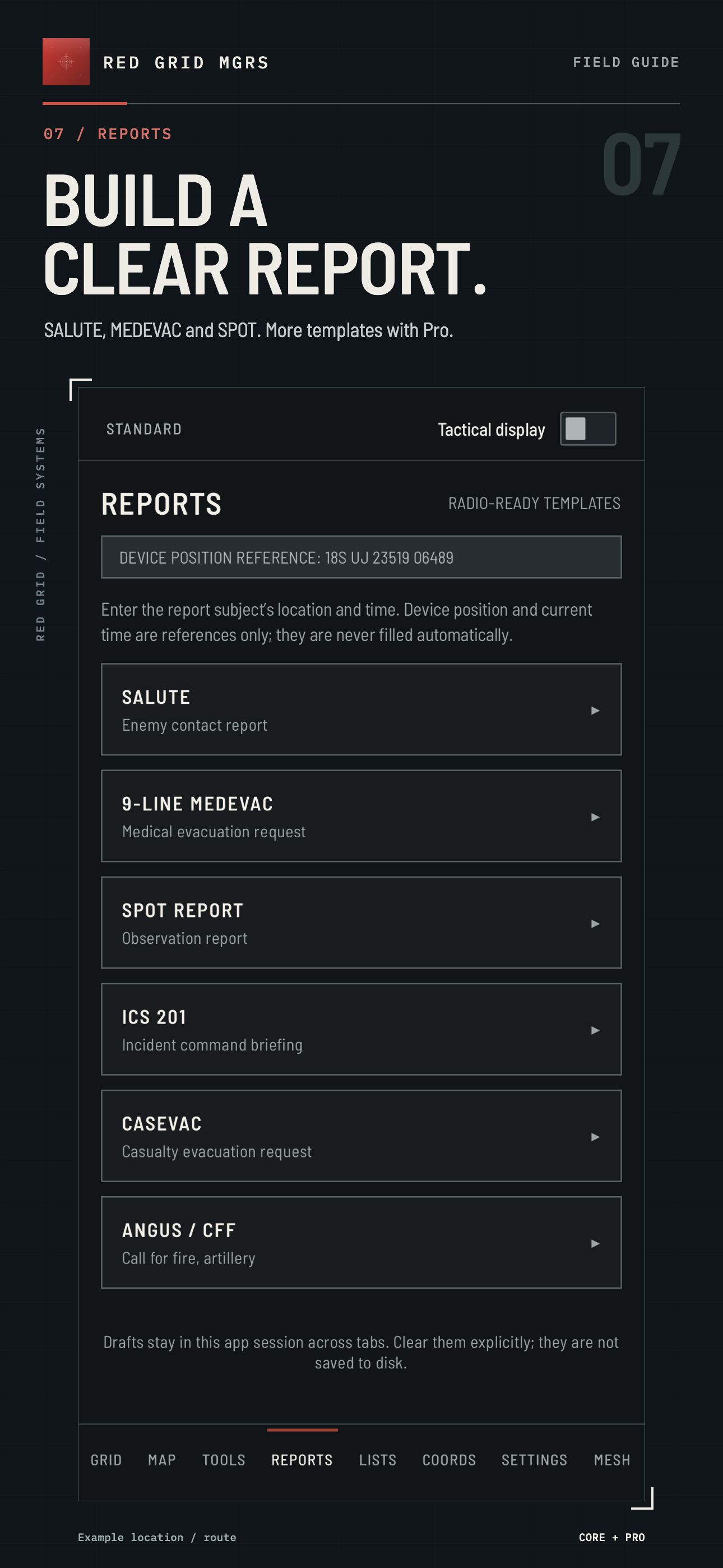
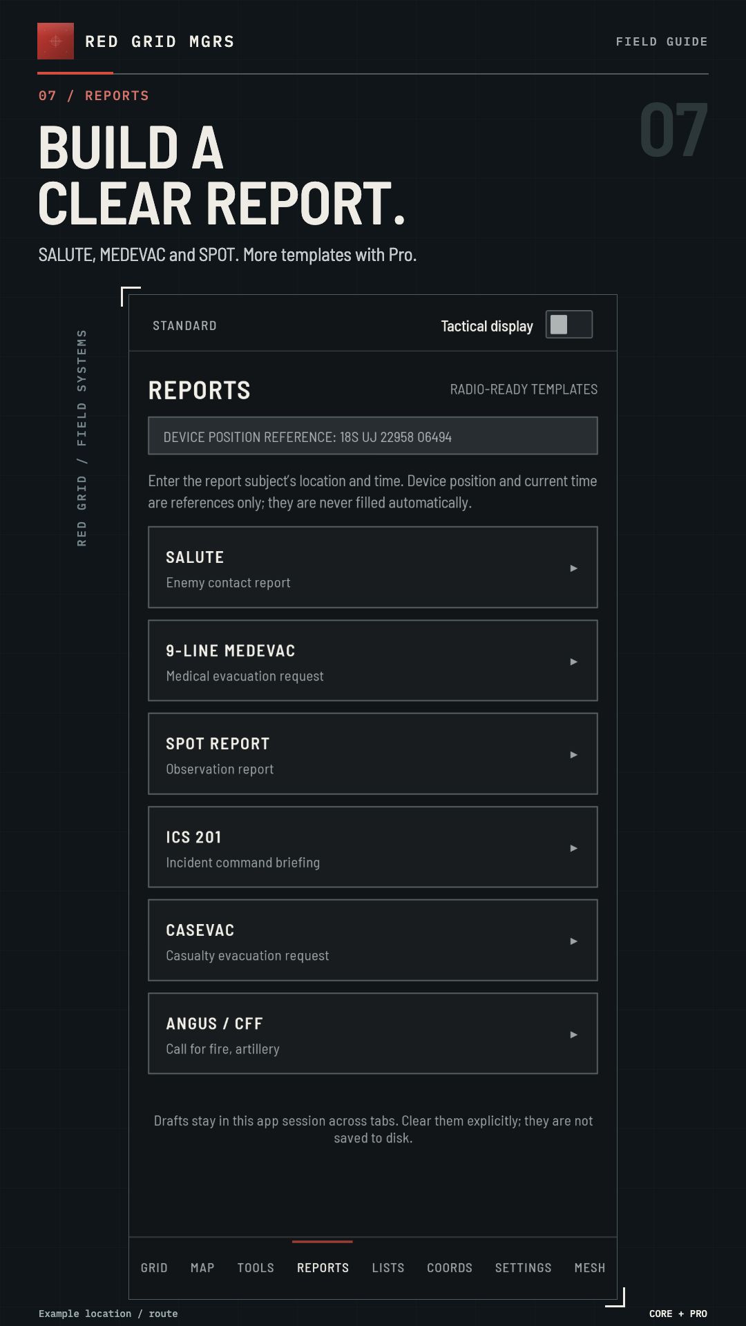
6 REPORT TEMPLATES3 free · all 6 with Pro
10-DIGIT GRIDFree for every user

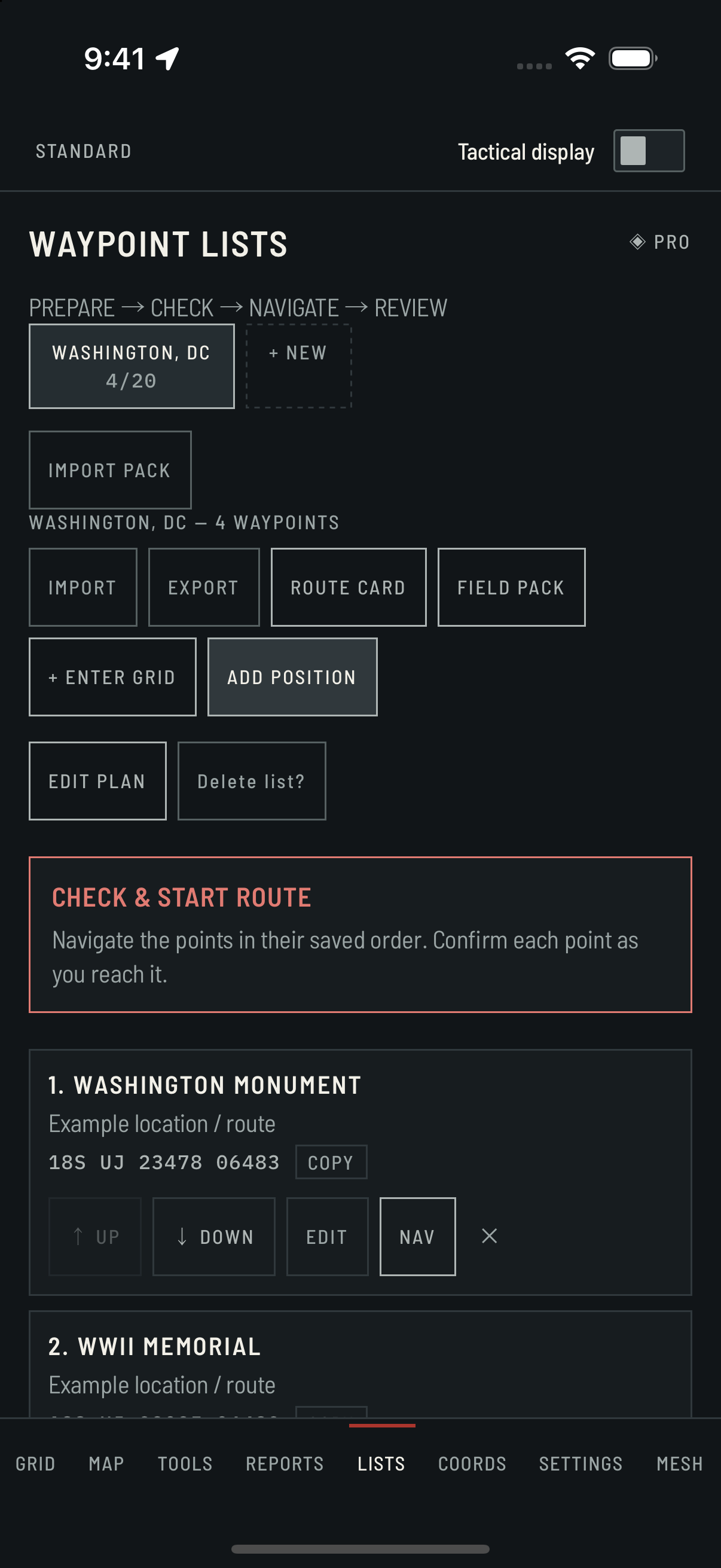
02 / PLAN / PRO

Save the points.
Work each leg.

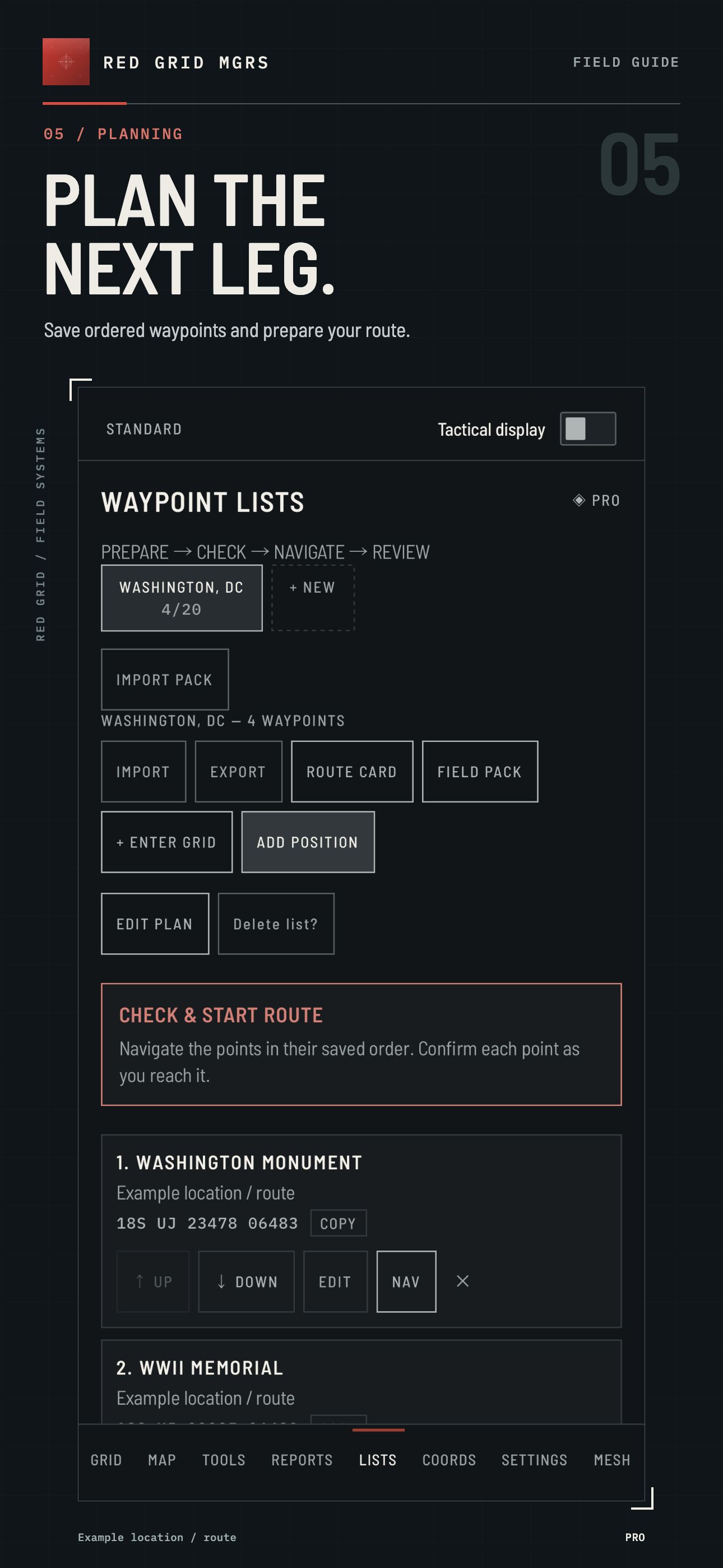
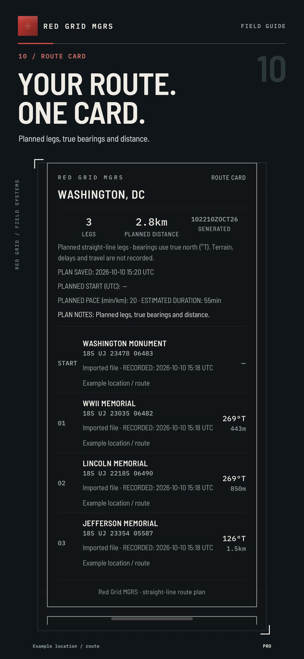
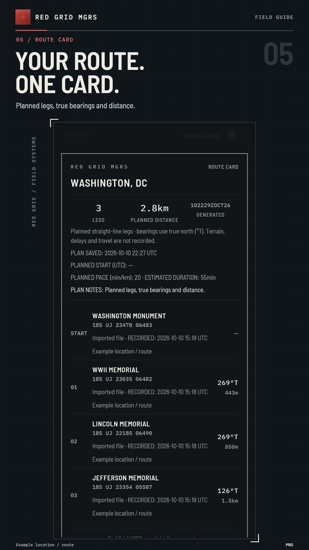
Name waypoint lists for a route, a set of checkpoints or locations you need to return to. Review each leg before stepping off.

  • Up to 10 lists, with 20 waypoints per list
  • Add your current position or enter a grid
  • Ordered route cards with bearing and distance
  • Export GPX, KML and field-ready text
Red Grid MGRS · PLAN THE NEXT LEG.
Captured on iOS 4.1.0 (88) · current release available in the stores · Pro enabled · example route

SINCE 4.0.6 / AVAILABLE NOW

A connected
field workflow.

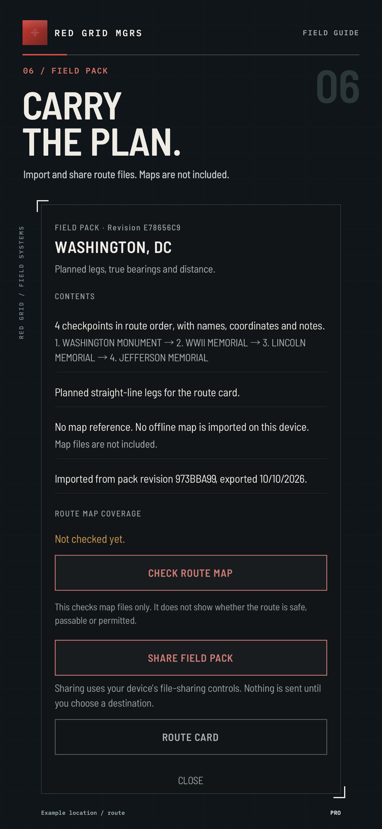
Version 4.0.6 connects saved lists to solo readiness checks, active route progress, manual waypoint confirmation and a local review. It also adds validated import of compatible raster MBTiles files you have permission to use.

Availability

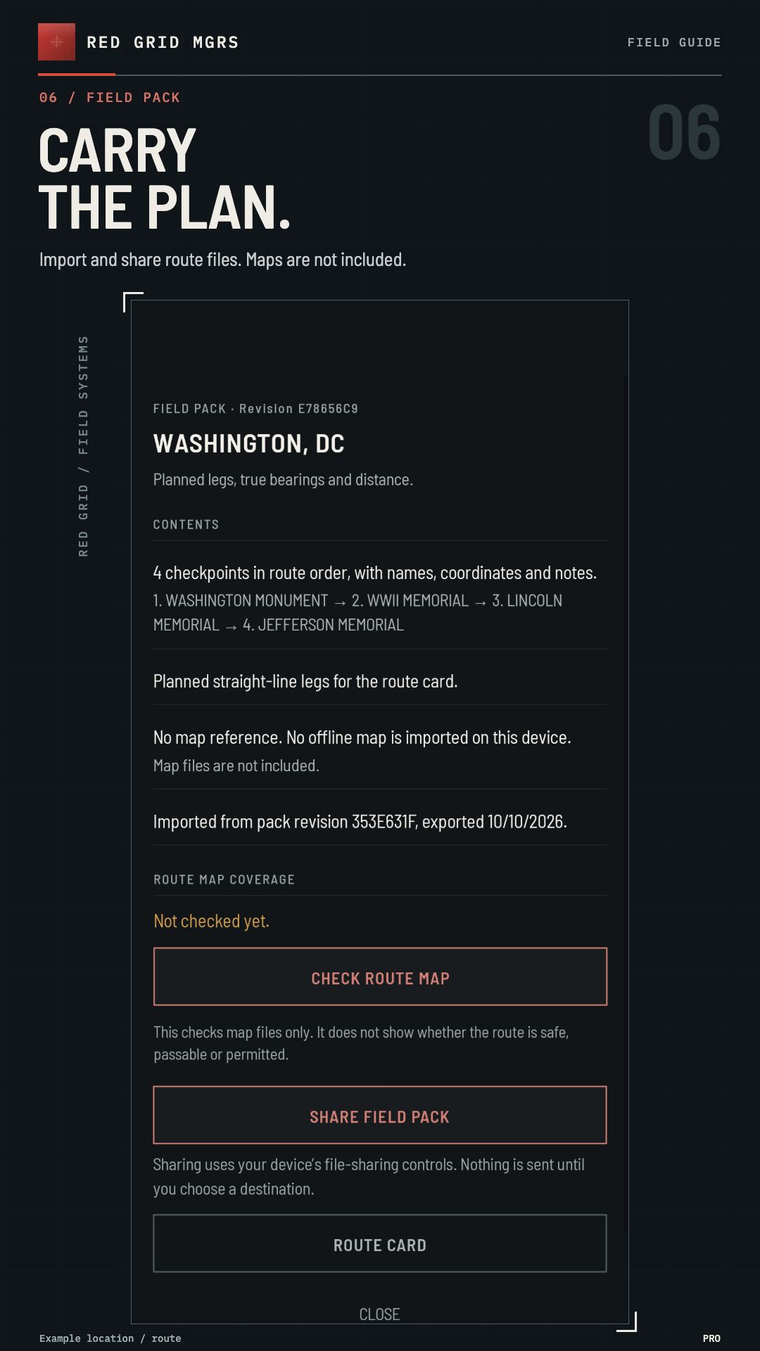
These changes have been in the public iOS and Android releases since 4.0.6. Route review records confirmed planned points and times, not a GPS movement track.

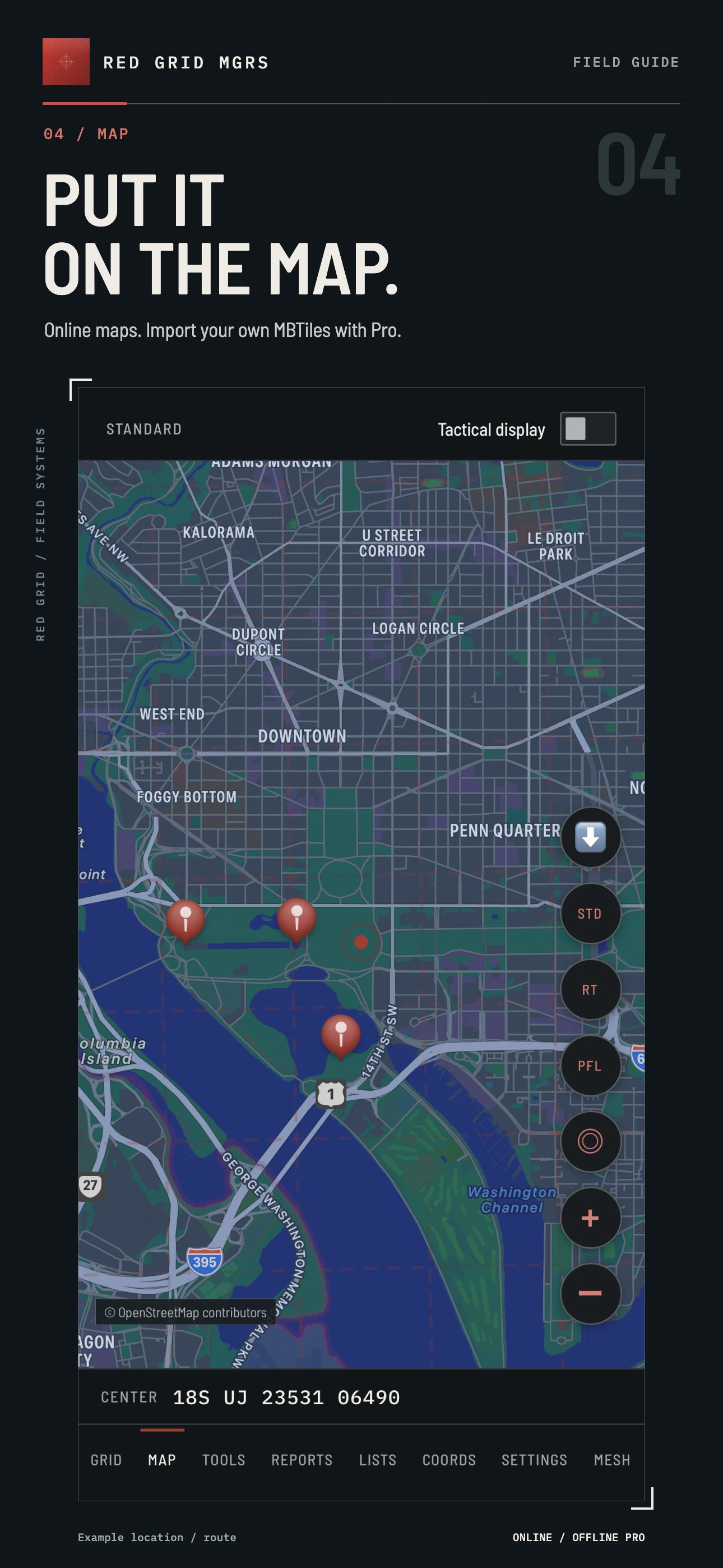
Map availability depends on the data you prepare. Check area and zoom coverage before leaving service.

03 / TOOLS & REPORTS

Useful when
the next step counts.

Navigation calculations, observation tools and structured reports support the work around your route.

FREE / 4 TOOLS

The essentials

Back azimuth · Pace count · Magnetic declination · Distress signalling

PRO / 8 MORE TOOLS

Build out the kit

Dead reckoning · Resection · Time / distance / speed · Sun & moon · MGRS precision · Elevation & slope · Photo geostamp · Barometer

FREE / 3 REPORTS

Report the situation

SALUTE · 9-Line MEDEVAC · SPOT

PRO / 3 MORE REPORTS

Record more detail

ICS 201 · CASEVAC · ANGUS / CFF

Sensor-dependent tools require compatible device hardware. Reports are templates for preparation and copying; they do not dispatch emergency services. The incident workspace keeps an ICS 214 activity log on your device: Pro is required to create or edit incidents and ICS 214 activity logs; saved records remain readable and exportable after a subscription expires. Exports are unsigned drafts for your own review.

BEFORE YOU LEAVE SERVICE

Check the grid.
Prepare the map.

Work through these checks before your first outing. Use a familiar area and confirm the results independently.

  1. Start on GRID. Obtain a usable location fix, read the complete MGRS reference and check its reported uncertainty. Ten digits describe a one-meter square, not one-meter GPS accuracy.
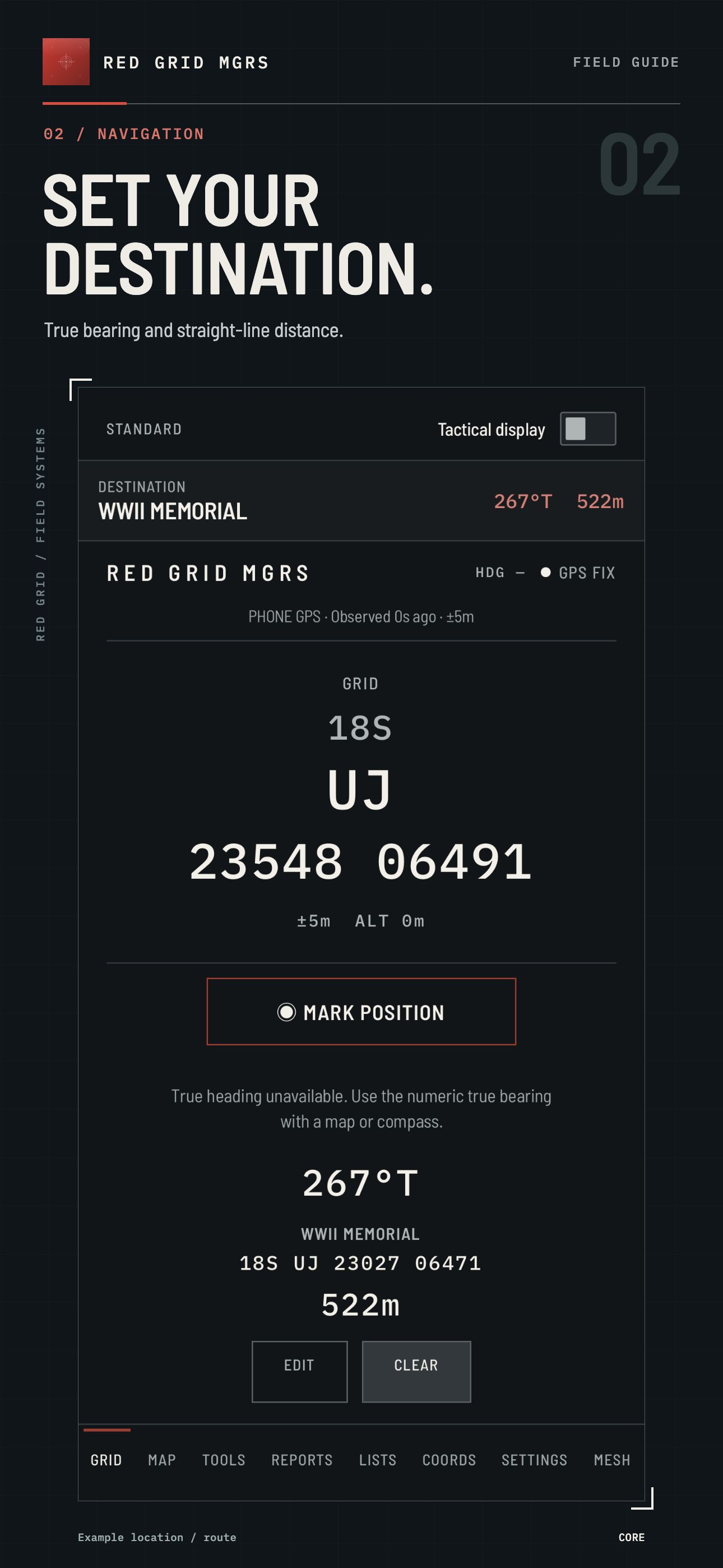
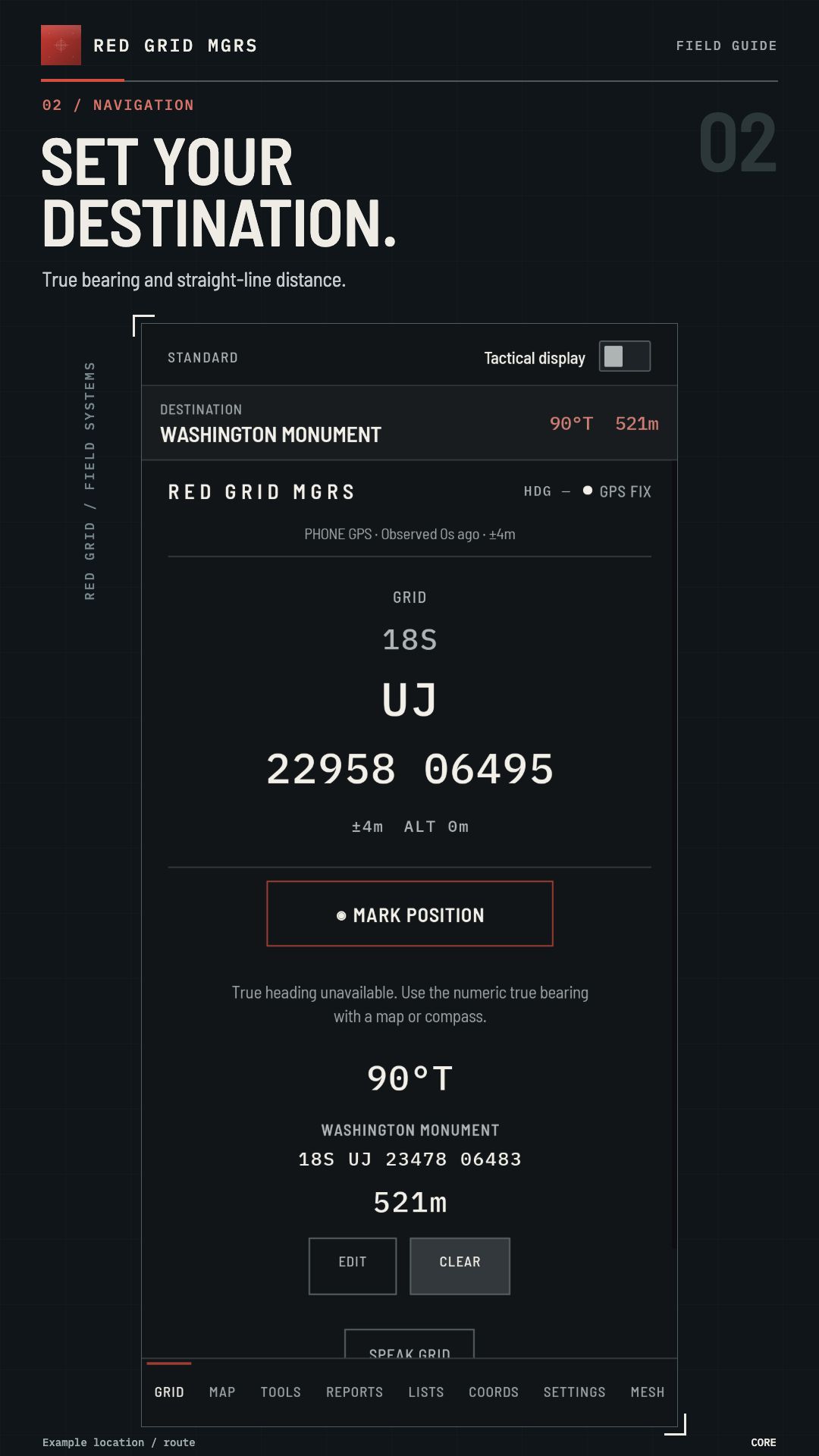
  2. Save a destination. Use MARK POSITION at a known point or enter a destination. Verify the full coordinate and bearing reference before following the direction arrow.
  3. Prepare a local map with Pro. Obtain a compatible MBTiles file you have permission to use, import it and inspect the needed area and detail levels. Maps are not included with the app.
  4. Check offline behavior. Disconnect network access while keeping location services enabled, reopen MAP and look for missing detail or blank areas. Reopen your saved destination and verify it is the intended point.

A route line is a plan, not proof of a safe path. Carry a map and compass and know how to use them. Read the complete preparation guide.

04 / FREE & PRO

Start with the grid.
Build out your field kit.

Use the core navigator free. Pro adds the tools for preparing routes, recording observations and working with a radio team.

FREE CORE

$0

10-digit MGRS and the essentials.
No Red Grid account required.

PRO MONTHLY

$3.99 / month

All Pro features.
Cancel through your app store.

PRO LIFETIME

$49.99 / once

Permanent Pro, including future Pro features.
Pay once. No renewal.

Compare Free and Pro
FIELD CAPABILITYFREEPRO
Full 10-digit MGRS · bearing & distanceIncludedIncluded
Active navigation waypoint1 waypoint1 waypoint
Saved waypoint lists & route cardsNot included10 lists · 20 points each
Field tools4 toolsAll 12 tools
Report templates3 reportsAll 6 reports
Incident workspace (ICS 214 activity log)Read & export saved recordsCreate & edit
Voice grid readout & HUDNot includedIncluded
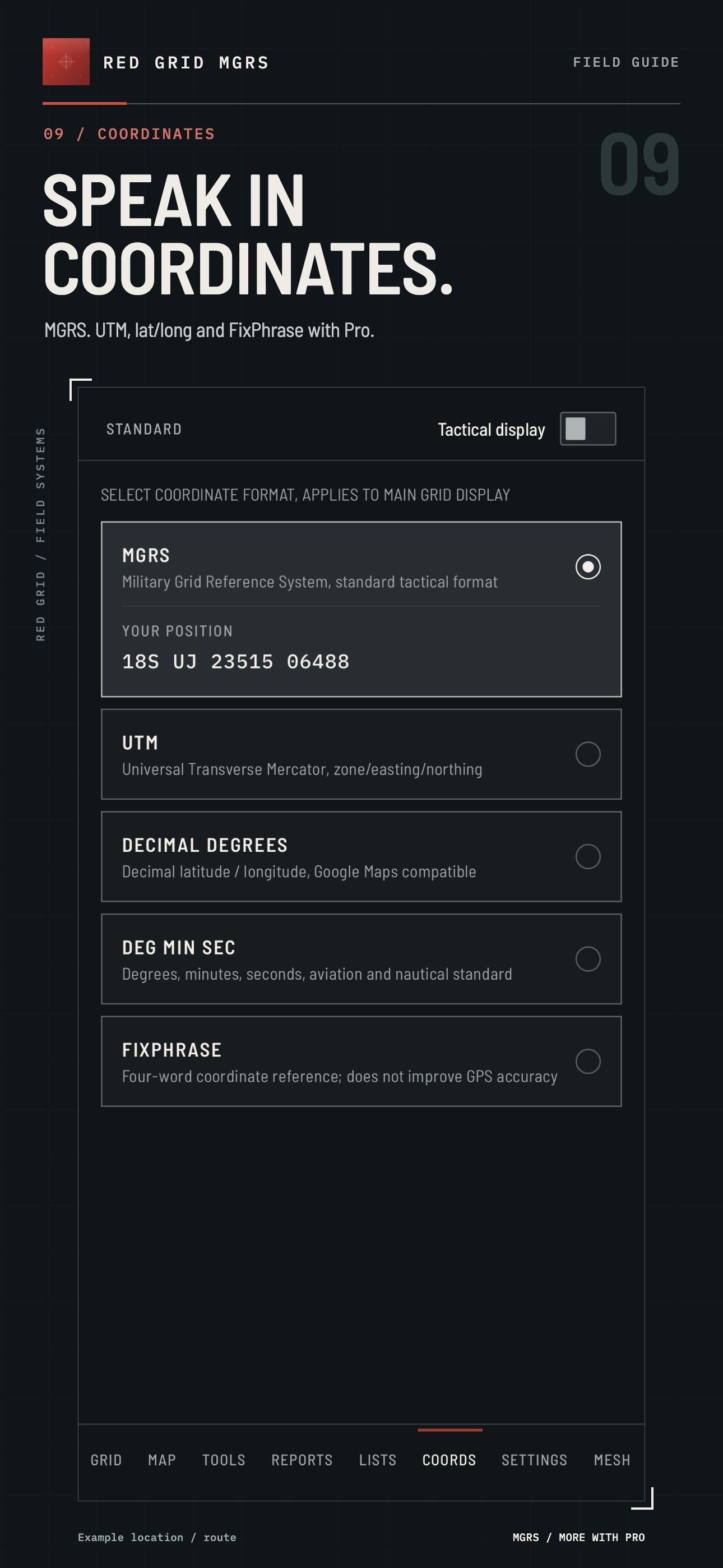
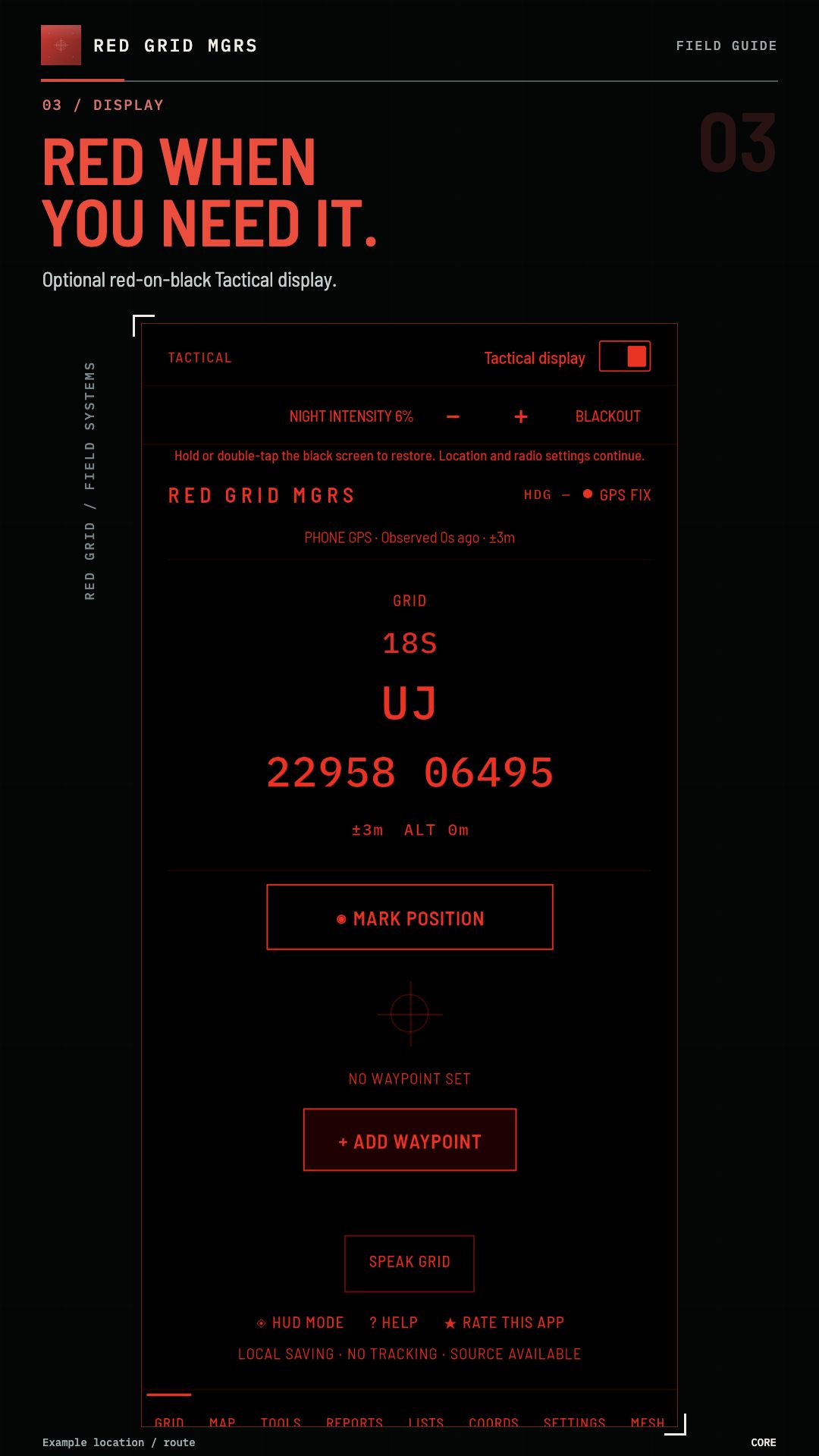
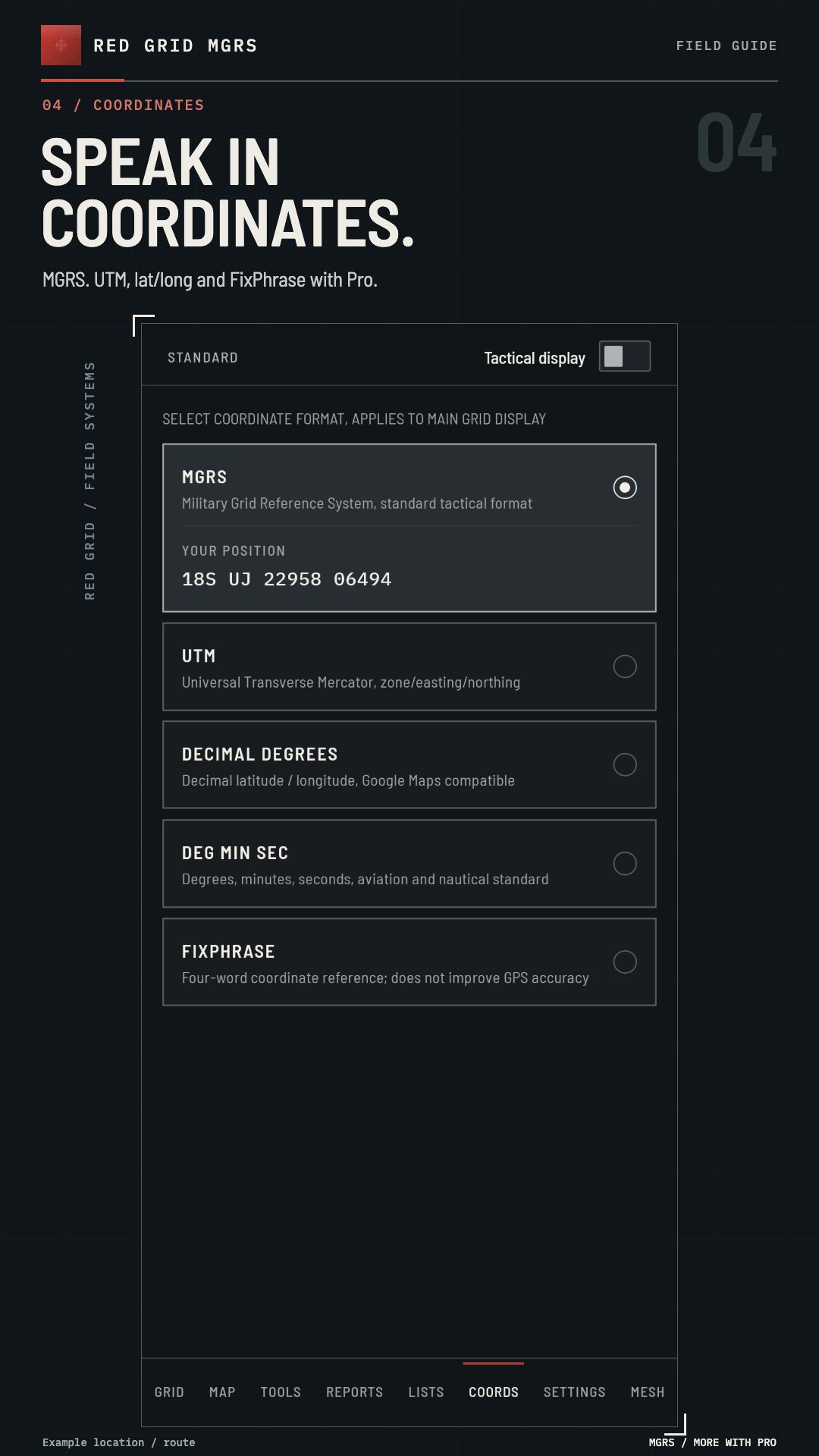
Additional coordinate formats & themesNot includedIncluded
Local MBTiles map importNot includedCompatible file required
Meshtastic team positions & messagingNot includedCompatible radios required

Prices shown in US dollars. Local prices and taxes may differ. Purchases are made in the app through Apple or Google. Monthly renews until cancelled.

Map files and radios are not included. Prepare a compatible raster MBTiles file you have permission to use and check coverage before departure. Team features require compatible Meshtastic radios, sold separately.

Pro is required to create or edit incidents and ICS 214 activity logs. Saved records remain readable and exportable after a subscription expires.

What does Lifetime Pro include?

Pay once for permanent access to all Pro features in Red Grid MGRS, including all future Pro features and updates we release for this app. Existing and new Lifetime purchasers keep Pro through major versions and redesigns, with no renewal, subscription or additional Pro upgrade fee.

Buying Lifetime does not automatically cancel an existing subscription. Cancel it separately through your app store.

Lifetime purchase terms
OPTIONAL / PRO + MESH RADIO

Team awareness.
With the right equipment.

Connect a compatible Meshtastic radio to your phone over Bluetooth. Team position updates and short messages travel between radios over LoRa. Set up and verify your team connection before relying on it in the field.

  • Pro required for the team features
  • Compatible radios are purchased separately
  • Range varies with terrain, antennas and configuration
  • No radio needed for solo navigation

PUBLIC SOURCE / PRACTICAL ACCESS

Inspect the code.
Use the app.

We publish the source so you can inspect how Red Grid works, report issues and build it for personal use under the license. The free store app makes core MGRS navigation accessible without developer tools. Optional Pro adds field capabilities and helps fund development, testing and maintenance.

Why source available?

Transparency lets technically minded users examine the calculations, local storage and radio implementation.

Why offer Pro?

Pro pays for a broader field kit in a maintained, ready-to-install app. Core 10-digit MGRS stays free.

The source uses MIT with Commons Clause, which restricts commercial use and reuse. This is source-available software. See the license for the exact terms.

Read the source ↗ · Read the license ↗

FIELD NOTES

Know what
you’re taking.

What works without cell service?

GPS grid coordinates, saved waypoints, navigation calculations, tools and report preparation run on your device. Your phone still needs a usable satellite fix. Map display depends on available map data; do not assume an area is available offline.

What is included free?

Full 10-digit MGRS, one active waypoint, bearing and distance, back azimuth, pace count, magnetic declination, distress signalling, and SALUTE, MEDEVAC and SPOT report templates. A 10-digit grid describes a one-metre square; it does not guarantee one-metre GPS accuracy.

Do I need a radio?

No radio is needed for solo navigation. Optional team position and messaging features require Pro and compatible Meshtastic radios. Phones connect to their radios over Bluetooth; the radios carry traffic over LoRa. Radio range depends on equipment and terrain.

Where does my field data go?

No Red Grid account is required. Saved waypoint lists are stored locally. From version 4.1.2, report worksheets and incident records are saved on your device once you save them and survive app restarts; wait for the saved confirmation before closing. Calculator and tool inputs stay in memory for the current session. Delete saved records in the app when you no longer need them, and keep your own exports or backups: uninstalling normally removes app-local data, while exported files and backups may remain, as described in the privacy policy. You can choose to export waypoint files or share information through connected radios. Map requests and app-store purchases use their respective providers. See the privacy policy for details.

How does Pro billing work?

Pro is available for US$3.99 per month or US$49.99 as a one-time Lifetime purchase. Both unlock all Pro features. Lifetime includes all future Red Grid MGRS Pro features and updates, with no renewal or additional Pro upgrade fee. Monthly subscriptions renew until cancelled through your store account. Prices and taxes vary by region; the store shows the final price.

Why publish source and charge for Pro?

We publish the source so you can inspect how Red Grid works, report issues and build it for personal use under the license. The free store app makes core MGRS navigation accessible without developer tools. Optional Pro adds field capabilities and helps fund development, testing and maintenance. The source is available under MIT with Commons Clause, which restricts commercial use and reuse; see the linked license for its terms.

RED GRID MGRS / IOS + ANDROID

Your next grid
starts here.

Download free. Add Pro when your field kit needs more.